From Orbit to the Corn Row: Comparing the Satellite Platforms Now Watching American Fields
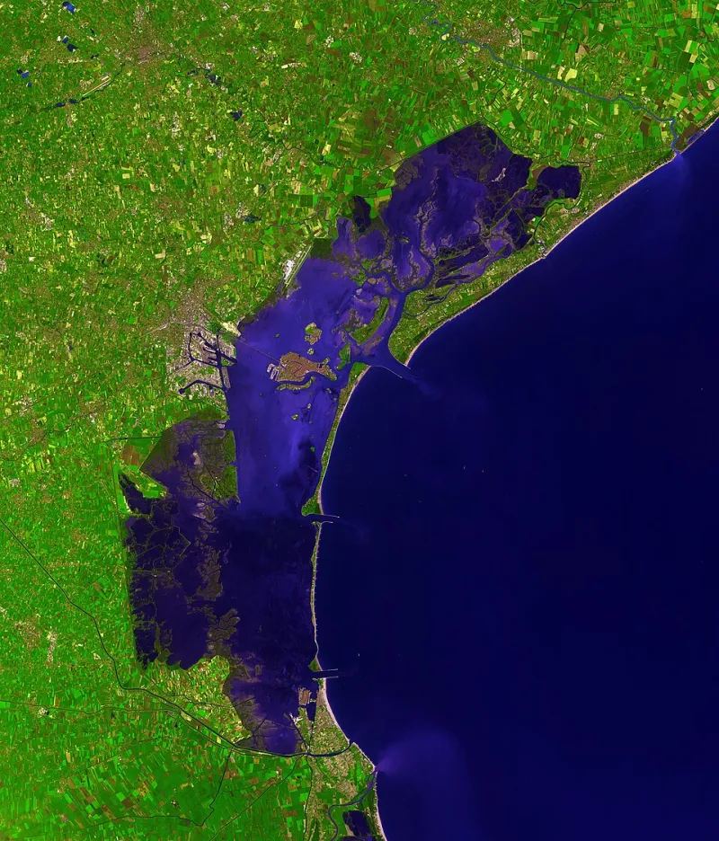
Photo: NASA/GSFC/MITI/ERSDAC/JAROS, and U.S./Japan ASTER Science Team, Public domain, via Wikimedia Commons
A generation ago, satellite imagery was something large co-ops and land-grant researchers used. Today, a soybean grower with a smartphone can pull field-level vegetation maps updated every few days. The catch is choosing among a crowded field of platforms. Here is a working comparison of five services US growers most often put to use.
1. USDA and NASA Public Imagery: The Free Foundation
The government's Landsat and Sentinel programs, distributed free through USDA tools and platforms like Crop Explorer, provide 10- to 30-meter resolution imagery revisited every five days or less. It will not spot a single stressed row, but for tracking district-level crop progress, comparing fields across a county, or grounding a marketing decision, it is unbeatable at the price. Best for: budget-conscious growers and those monitoring rented ground at scale.
2. Sentinel Hub and Open-Data Dashboards: The Tinkerer's Choice
Built on the same European Sentinel data, platforms that let users configure their own vegetation-index dashboards offer 10-meter imagery at roughly five-day revisit rates, with free tiers for modest acreage. The learning curve is real, but growers comfortable with spreadsheets can build custom NDVI views for corn and soybean fields. Best for: tech-comfortable operators and consultants.
3. OneSoil: The Accessible Middle Ground
OneSoil provides free field boundary mapping and vegetation monitoring, with paid tiers adding historical analysis and scouting notes. Resolution and revisit rates mirror Sentinel's open data. Specialty crop growers in California's Salinas Valley have used it for broad zone mapping, though fine detail on high-value vegetable blocks often requires something sharper. Best for: row-crop growers taking a first step into satellite scouting.
4. EOS Crop Monitoring: The Subscription Analyst
EOS offers 10-meter imagery with frequent revisits, weather integration, and yield-relevant analytics under a per-hectare subscription — pricing that works out to a few dollars per acre annually for most operations. Its strength is translating raw imagery into actionable zones for variable-rate nitrogen on corn. Best for: mid-sized grain operations ready to pay for interpretation, not just pictures.
5. Planet and Commercial Constellations: The Premium Eye
At the top of the market, daily-imaging constellations deliver roughly 3-meter resolution — enough to distinguish individual specialty-crop blocks and catch irrigation failures within a day. Costs run considerably higher, which is why the customers are typically vineyards, orchards, and large vegetable producers where one missed stress event can erase the margin on a block. Best for: high-value perennial and specialty crops.
Matching the Tool to the Field
The honest answer to "is satellite data worth the spend?" is that it depends on crop value and problem type. For corn and soybeans, free and low-cost platforms cover most scouting and zoning needs. For specialty operations, daily high-resolution imagery can pay for itself in a single season of early stress detection.
A practical rule of thumb: start free, log what the imagery actually changed in your decisions for a season, and only then graduate to a paid subscription. The sky is watching either way — the question is how much you need it to tell you.